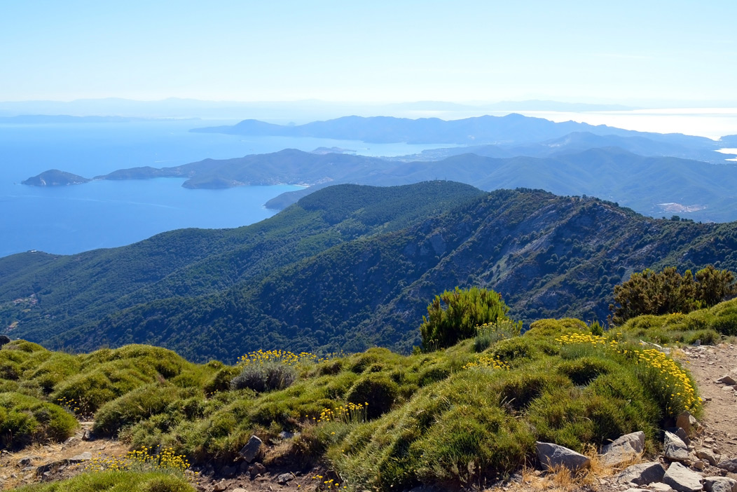
According to legend, the Tuscan Archipelago originated from a necklace that slipped from Venus’s neck and fell into the sea. And indeed, Italy’s third-largest island possesses a large variety of natural environments that give it an almost divine appearance. It is a disarming beauty that bewitches visitors and invites them to visit the island’s most hidden ravines. Many can be reached only on foot, through equally evocative itineraries climbing up the hills and brushing up against inlets, bays, and coves. In just a few kilometres, we may admire the sea and reach the island’s highest peak (Mount Capanne), from which to enjoy a vista without parallel.
We may come upon what remains of an ancient Etruscan fort and then dive into the clear waters of an inlet just a few hundred metres away. The perfect facility for lodging during a hiking vacation? Hotel Airone, located a short distance from Portoferraio and from all the island’s most evocative destinations.
The “Red Rocks” itinerary
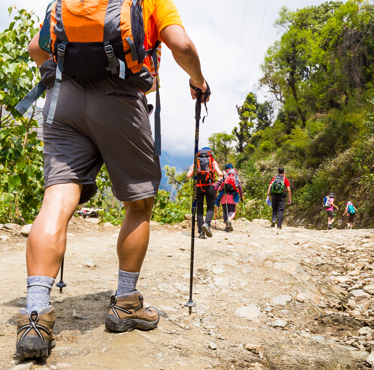
Without a doubt, one of the most scenic itineraries on the entire island winds from the Nisportino to the Mangani beach. It is short, suitable for all, and well-maintained.
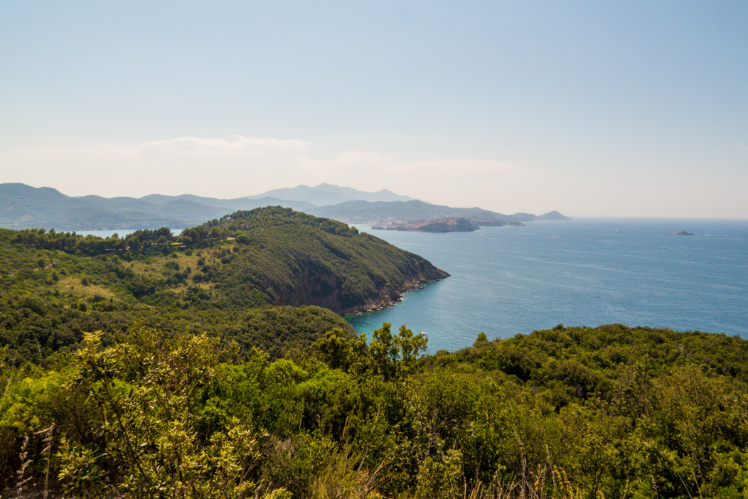
From Nisportino, we take path 265, which reaches the Punta delle Casette Promontory and continues on to immerse itself in the Mediterranean maquis up to the “Red Rocks” coastline, from which an exceptional vista over the Portoferraio roadstead may be enjoyed.
After a rather demanding stretch, the Mangani cove offers an opportunity to spend a few hours in a marvellous place that is often deserted, even in the middle of the summer.
From Rio nell’Elba to Mount Giove
The itinerary starts from Rio nell’Elba, a characteristic village about 200 metres above sea level. Just outside town, we take the road exiting the Castilian gate towards Volterraio, up to the intersection with the provincial road originating from Portoferraio, in the locality known as “Le Panche.”
From here, we continue on to the peak of Mount Capannello (496 metres). Continuing to walk along the crest, we can enjoy an incredible landscape dominating both Elba’s northern and southern coastline.
Upon descending from Mount Strega, we encounter the provincial road from which another, unpaved road begins, leading to the hermitage of Saint Catherine. The last climb leads to the fortress of Giove, a fascinating ruin dating to the fourteenth century.
Ascent to Mount Capanne
From the Medieval village of Marciana, Elba’s highest town, we ascend towards the thirteenth-century fortress before encountering the path that crosses the Pedalta valley. From here, we have to reach the 530-metre elevation of the hermitage of San Cerbone, dating to 1421. The path leading to the peak begins amid oak and chestnut trees.
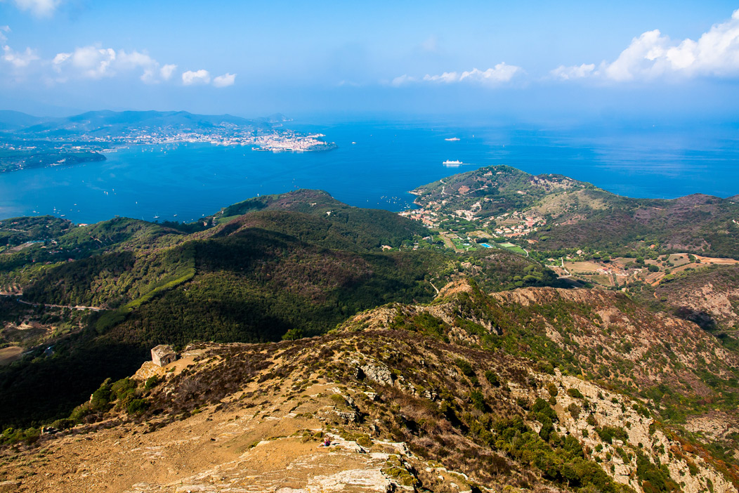
After a few hundred metres, the path becomes scenic, dominating over the Nivera valley and, slightly higher up, all of Elba, the Corsican coastline, and part of Tuscany. In some points, the path becomes rockier, but not impossible. Moreover, as we climb, we might even catch sight of the mouflons that populate this part of the island!